
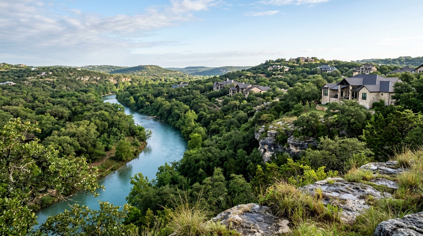
What flood zone questions should Hill Country buyers ask before buying near the Guadalupe River?
Quick Answer
Hill Country buyers should ask whether the property is in a FEMA 1 percent floodplain, a 0.2 percent floodplain, or outside the mapped floodplain but still near drainage, low water crossings, creeks, or river rise areas. FEMA defines the 1 percent floodplain as land with a 1 percent annual chance of flooding, and the 0.2 percent floodplain as land with a 0.2 percent annual chance, but 2025 Guadalupe River flooding showed mapped zones are only one part of the risk conversation. Buyers should verify flood maps, elevation, insurance, drainage, access routes, and disclosure details before they fall in love with a river or creek-area property. For expert updates, contact Cody Posey Real Estate.
Why do flood zone questions matter more in the Hill Country now?
Flood zone questions matter in the Texas Hill Country because water moves differently here than it does in flatter parts of the state. The Guadalupe River, Comal River, Cibolo Creek, dry washes, limestone channels, and steep drainage corridors can turn a normal-looking property conversation into a very specific due diligence issue. That does not mean every Hill Country home is a flood problem. It means buyers need to understand the property, the map, the elevation, and the access routes before they treat a pretty setting as the whole story.
The City of Guadalupe floodplain guidance explains the core FEMA language most buyers hear first. A 1 percent floodplain is land covered by water during a flood event with a 1 percent chance of being equaled or exceeded in any year. A 0.2 percent floodplain is land covered by water during an event with a 0.2 percent chance in any year. Base Flood Elevation, or BFE, is the projected elevation of floodwater in that 1 percent annual chance event. Those definitions are useful, but they are starting points, not the finish line.
What I see with New Braunfels and Hill Country buyers is that the first question is usually too small: "Is it in the flood zone?" The better question is, "What is the full water-risk picture for this exact property?" A home can be outside a mapped high-risk area and still have drainage issues, a creek behind the lot, a low approach road, an old slab elevation, or insurance questions that affect ownership cost. That is why I pair floodplain review with the same practical buyer work I use in a broader Texas Hill Country septic disclosure check: read the documents, verify the systems, and do not let the scenery do the thinking.
The 2025 Guadalupe River flooding made that discipline even more important. ABC News reported that satellite data showed water extending hundreds of feet outside the Guadalupe River's banks in places and beyond some FEMA estimates, with coverage noting that water was higher than the predicted 0.2 percent chance flood hazard in some areas. That kind of event does not mean every mapped property is wrong. It means buyers should not treat a map color as the whole answer, especially in a river corridor known for fast-moving water.
What should buyers check beyond the FEMA flood map?
The FEMA map is the first checkpoint. Buyers should look up the property through the FEMA Flood Map Service Center, verify the flood zone, and ask whether any portion of the structure, driveway, detached building, or lot sits in a mapped hazard area. If the property appears near a boundary line, the next conversation should be about elevation documentation, survey details, and whether a lender or insurer may ask for more information. A small shift on a map can feel abstract online, but it can matter a lot when a buyer is trying to close, insure, and understand the property.
Insurance is the second checkpoint. FEMA's Flood Map Service Center notes that most homeowners insurance does not cover flood damage, and that buyers may need flood insurance whether they are in a high-risk zone or not. FEMA also states that people in low or moderate flood-risk areas are 5 times more likely to experience a flood than a fire over the next 30 years, and that for many, a National Flood Insurance Program policy could cost less than $400 per year. Those are national FEMA statements, not a quote for a specific New Braunfels or Guadalupe River property. The real number depends on the address, elevation, coverage, property characteristics, and insurer.
Access is the third checkpoint, and this is where a lot of out-of-area buyers get surprised. In the Hill Country, the house itself might sit high, but the road in, bridge nearby, low water crossing, or drainage route can still affect daily life during heavy rain. I do not want a buyer learning that after closing. I want them asking before option period ends: how does water leave this lot, where does it cross the road, what happens between the property and work, groceries, medical care, and schools as factual district boundaries, and has the seller disclosed prior water intrusion or drainage problems?
This is also where lifestyle and ownership cost connect. A river-adjacent property, a Canyon Lake-area cabin, or a home near a dry creek can be a great fit for the right buyer, but it has to be evaluated with the same calm attention as price, taxes, and repairs. If you are comparing river and lake settings, the due diligence overlaps with the tradeoffs I laid out in river vs lake property in the Texas Hill Country. The view matters, but the route, elevation, insurance, and maintenance picture matter just as much.
Trying to compare Hill Country homes without guessing which flood and river details actually matter?
Cody will help you compare areas, property tradeoffs, floodplain questions, insurance checkpoints, and commute realities before you commit to a short list.
Call Cody Posey Real Estate at 830.360.5569 · Compare Hill Country areas that fit how you live
How should flood risk affect an offer in New Braunfels or the Guadalupe River corridor?
Flood risk should not automatically make a buyer walk away, and it should not be ignored because the home photographs well. It should shape the offer strategy. In Texas, the option period gives buyers time to inspect and investigate, and floodplain questions belong near the top of that list when a property is near the Guadalupe River, Comal River, Cibolo Creek, Canyon Lake drainage, or a low-lying Hill Country route. The buyer's offer should leave enough room to verify insurance cost, flood maps, survey information, property condition, and seller disclosures.
A strong flood-risk review starts with documents. Buyers should look for the seller's disclosure, prior flood or water intrusion notes, drainage repairs, elevation certificate if available, survey, FEMA map panel information, and insurance history the seller can lawfully provide. If the property is in an HOA or subdivision with drainage infrastructure, buyers should review what the association maintains and what remains the owner's responsibility. In unincorporated areas, the conversation may also include county floodplain rules, septic location, well location, driveways, culverts, and whether improvements were permitted.
This is exactly the kind of question I walk clients through before they spend inspection money. I do not want them relying on a listing description that says "not in floodplain" without verifying what that means. Does it refer to the structure, the lot, the old map, the current map, or a seller's best memory? In a fast-moving river market, vague flood language is not enough. The right answer is property-specific, documented, and reviewed early enough to still negotiate or terminate under the contract timeline.
Offer terms should also reflect how competitive the property really is. A clean, elevated home with strong documentation may support a more confident offer than a similar-looking home with unclear map status, no elevation information, prior water signs, or expensive insurance. That is the same thinking buyers should bring to inspections generally. If you need a refresher on how repair and due-diligence conversations work in this market, start with Texas inspection requests in New Braunfels, then apply that same discipline to water risk.
What local details should relocating buyers understand before choosing a Hill Country area?
Relocating buyers often picture the Hill Country as one simple lifestyle choice: trees, views, water, and more space. The reality is more detailed. New Braunfels, Gruene, River Chase, Canyon Lake, Sattler, Startzville, Spring Branch, Bulverde, Garden Ridge, and Seguin can all have different combinations of elevation, drainage, road access, utility setup, HOA rules, septic, well, floodplain exposure, and commute patterns. Two homes can be five miles apart and have very different risk profiles.
The Texas Water Development Board identifies the Guadalupe Flood Planning Region as a major planning area, and notes that the Comal, Blanco, and San Marcos Rivers feed the Guadalupe along this region, with the San Antonio River joining before the Guadalupe reaches the bay system. That matters because local water questions are connected across a wider basin, not just the lot line of one house. Comal County also maintains flood resources, including public tools related to how the Guadalupe River moves through the region.
Here is the local-only part buyers miss: the most important flood question is not always the one printed on the listing. Around New Braunfels and the river corridor, I want to know whether the buyer can live with the whole pattern of the property. Can they handle the insurance number? Are they comfortable with the road access? Do they understand the difference between river charm and river responsibility? Are they buying a weekend-feeling property with full-time expectations? A house can be beautiful and still be the wrong fit if the water-risk conversation gets rushed.
The best approach is to compare areas before narrowing to addresses. Some buyers belong closer to town with city utilities and simpler maintenance. Some want acreage or a Canyon Lake-area setting and are comfortable doing more due diligence. Some want Guadalupe River access but need a very clear budget for insurance, upkeep, and emergency planning. If you are still sorting out the broader fit, use Cody's Hill Country area comparison resources and pair them with address-level flood review before you choose a property.
How to review flood risk before you make an offer
- Check the FEMA Flood Map Service Center for the exact address and note whether the structure, lot, or nearby access appears in a mapped floodplain.
- Ask for seller disclosure details, prior water intrusion history, survey information, elevation documents if available, and insurance information the seller can provide.
- Get a flood insurance estimate early, even if the home is outside a high-risk zone, because standard homeowners insurance usually does not cover flood damage.
- Review access routes, low water crossings, drainage paths, culverts, creeks, and nearby river or lake conditions before the option period deadline.
- Compare the property's flood-risk picture against your budget, timeline, and comfort level before you decide whether to negotiate, proceed, or walk away.
In Closing
If you're planning a Hill Country move near New Braunfels, Canyon Lake, the Guadalupe River, or another water-influenced area in the next 3 to 6 months, the next step is not guessing from a map screenshot. It's comparing the property, floodplain, insurance, access, and lifestyle tradeoffs before you get emotionally locked into one address.
I'll help you build a clean shortlist, flag the right questions during option period, and connect the flood-risk conversation to the real ownership numbers so you can move forward with clarity.
Ready to talk strategy? Cody Posey Real Estate at 830.360.5569.
Sources: City of Guadalupe Floodplain Information · ABC News: FEMA maps underestimated risk in catastrophic Texas flood · FEMA Flood Map Service Center · Texas Water Development Board Region 11, Guadalupe Flood Planning Region · Comal County Flood Resources